Category Archives: OSGeo

Inofficial QGIS 2.8 RPMs for EPEL 7: Fedora 20, Fedora 21, Centos 7, Scientific Linux 7

qgis-icon_smallThanks to the work of Devrim Gündüz, Volker Fröhlich, Dave Johansen, Rex Dieter and other Fedora/EPEL packagers I had an easy going to prepare RPM packages of QGIS 2.8 Wien for Fedora 20 and 21, Centos 7, and Scientific Linux 7.

The base SRPM package I copied from Fedora’s koji server, modified the SPEC file in order to remove the now outdated PyQwt bindings (see bugzilla) and compiled QGIS 2.8 via the great COPR platform.

Repo: https://copr.fedoraproject.org/coprs/neteler/QGIS-2.8-Wien/

The following packages can now be installed and tested on epel-7-x86_64 (Centos 7, Scientific Linux 7, etc.), Fedora-20-x86_64, and Fedora-21-x86_64:

  • qgis 2.8.1
  • qgis-debuginfo 2.8.1
  • qgis-devel 2.8.1
  • qgis-grass 2.8.1
  • qgis-python 2.8.1
  • qgis-server 2.8.1

Installation instructions (run as “root” user or use “sudo”):

# EPEL7:
yum -y install epel-release
yum -y install wget
# https://copr.fedoraproject.org/coprs/neteler/python-OWSLib/
wget -O /etc/yum.repos.d/neteler-python-OWSLib-epel-7.repo https://copr.fedoraproject.org/coprs/neteler/python-OWSLib/repo/epel-7/neteler-python-OWSLib-epel-7.repo
yum -y update
yum -y install python-OWSLib
wget -O /etc/yum.repos.d/qgis-epel-7.repo https://copr.fedoraproject.org/coprs/neteler/QGIS-2.8-Wien/repo/epel-7/neteler-QGIS-2.8-Wien-epel-7.repo
yum update
yum install qgis qgis-grass qgis-python qgis-server

# Fedora 20:
wget -O /etc/yum.repos.d/qgis-epel-7.repo https://copr.fedoraproject.org/coprs/neteler/QGIS-2.8-Wien/repo/fedora-20/neteler-QGIS-2.8-Wien-fedora-20.repo
yum update
yum install qgis qgis-grass qgis-python qgis-server

# Fedora 21:
wget -O /etc/yum.repos.d/qgis-epel-7.repo https://copr.fedoraproject.org/coprs/neteler/QGIS-2.8-Wien/repo/fedora-21/neteler-QGIS-2.8-Wien-fedora-21.repo
yum update
yum install qgis qgis-grass qgis-python qgis-server

The other packages are optional (well, also qgis-grass, qgis-python, and qgis-server…).

Enjoy!

PS: Of course I hope that QGIS 2.8 officially hits EPEL7 anytime soon! My COPR repo is just a temporary bridge towards that goal.

EDIT 30 April 2015:

  • updated EPEL7 installation for python-OWSLib dependency

New stable release of GRASS GIS 7.0.0!

The GRASS GIS Development team has announced the release of the new major version GRASS GIS 7.0.0. This version provides many new functionalities including spatio-temporal database support, image segmentation, estimation of evapotranspiration and emissivity from satellite imagery, automatic line vertex densification during reprojection, more LIDAR support and a strongly improved graphical user interface experience. GRASS GIS 7.0.0 also offers significantly improved performance for many raster and vector modules: “Many processes that would take hours now take less than a minute, even on my small laptop!” explains Markus Neteler, the coordinator of the development team composed of academics and GIS professionals from around the world. The software is available for Linux, MS-Windows, Mac OSX and other operating systems.

Detailed announcement and software download:
http://grass.osgeo.org/news/42/15/GRASS-GIS-7-0-0/

About GRASS GIS
The Geographic Resources Analysis Support System (http://grass.osgeo.org/), commonly referred to as GRASS GIS, is an open source Geographic Information System providing powerful raster, vector and geospatial processing capabilities in a single integrated software suite. GRASS GIS includes tools for spatial modeling, visualization of raster and vector data, management and analysis of geospatial data, and the processing of satellite and aerial imagery. It also provides the capability to produce sophisticated presentation graphics and hardcopy maps. GRASS GIS has been translated into about twenty languages and supports a huge array of data formats. It can be used either as a stand-alone application or as backend for other software packages such as QGIS and R geostatistics. It is distributed freely under the terms of the GNU General Public License (GPL). GRASS GIS is a founding member of the Open Source Geospatial Foundation (OSGeo).

Happy 9th Birthday, OSGeo!

Press release by Jeff McKenna, OSGeo Foundation President

9 years ago today was the first ever meeting of the OSGeo foundation, in Chicago U.S.A. (initial press release). Thanks to those passionately involved back then, and the thousands contributing since, now our community has expanded and has reached many countries all over world. Congratulations to everyone for continuing to share the passion for Open Source geospatial.

Here is a glimpse at some of the exciting events happening around the world this year:

Landsat 8 captures Trentino in November 2014

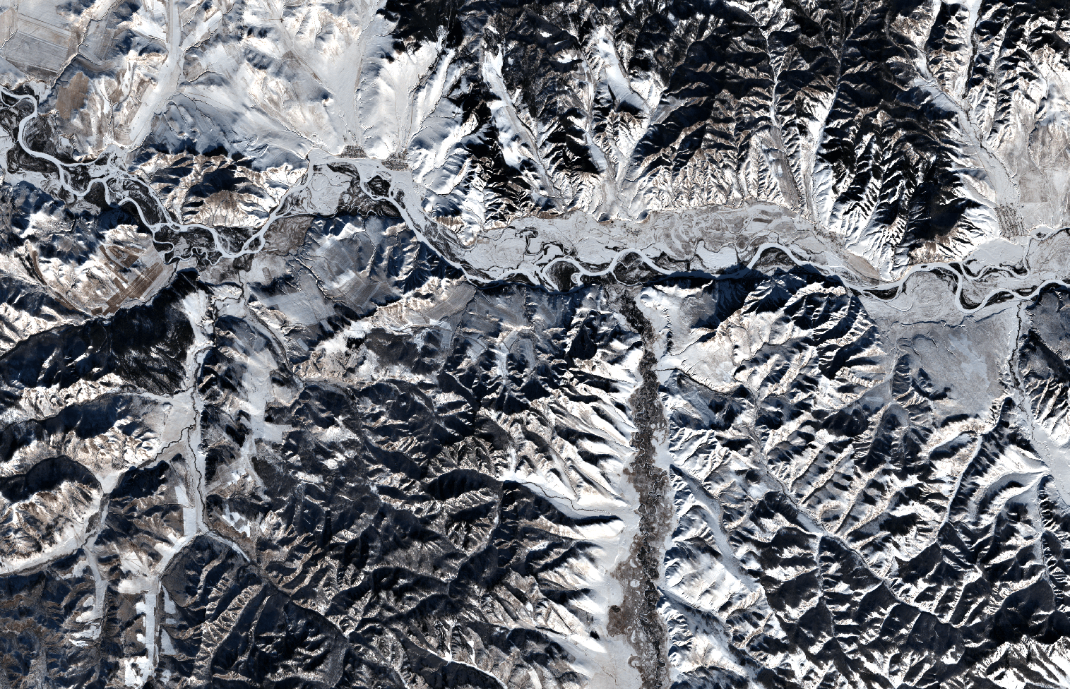
The beautiful days in early November 2014 allowed to get some nice views of the Trentino (Northern Italy) – thanks to Landsat 8 and NASA’s open data policy:

Landsat 8: Northern Italy 1 Nov 2014

Trento captured by Landsat8

Landsat 8: San Michele - 1 Nov 2014
Landsat 8: San Michele – 1 Nov 2014

The beauty of the landscape but also the human impact (landscape and condensation trails of airplanes) are clearly visible.

All data were processed in GRASS GIS 7 and pansharpened with i.fusion.hpf written by Nikos Alexandris.

QGIS 2.6 ‘Brighton’ released

In the new release of QGIS 2.6.0 a series of new features have been added concerning

  • General: new features and bugfixes,
  • DXF export (improvements),
  • Map Composer (enhancements),
  • Processing (including a new modeler implementation),
  • QGIS Server (improvements),
  • Symbology (including user interface improvements),
  • User Interface with improvements.

A visual changelog is available for more details with lots of screenshots.

Congratulations to all QGIS developers! Looking forward to see the Fedora RPM available…

You can download QGIS 2.6 at http://qgis.org/en/site/forusers/download.html

Selective data removal in an elevation map by means of floodfilling

Do you also sometimes get maps which contain zero (0) rather than NULL (no data) in some parts of the map? This can be easily solved with “floodfilling”, even in a GIS.

My original map looks like this (here, Trentino elevation model):

The light blue parts should be no data (NULL) rather than zero (0)...

Now what? In a paint software we would simply use bucket fill but what about GIS data? Well, we can do something similar using “clumping”. It requires a bit of computational time but works perfectly, even for large DEMs, e.g., all Italy at 20m resolution. Using the open source software GRASS GIS 7, we can compute all “clumps” (that are many for a floating point DEM!):

# first we set the computational region to the raster map:
g.region rast=pat_DTM_2008_derived_2m -p
r.clump pat_DTM_2008_derived_2m out=pat_DTM_2008_derived_2m_clump

The resulting clump map produced by r.clump is nicely colorized:

Clumped map derived from DEM (generated with r.clump)

As we can see, the area of interest (province) is now surrounded by three clumps. With a simple map algebra statement (r.mapcalc or GUI calculator) we can create a MASK by assigning these outer boundary clumps to NULL and the other “good” clumps to 1:

r.mapcalc "no_data_mask = if(pat_DTM_2008_derived_2m_clump == 264485050 || \
  pat_DTM_2008_derived_2m_clump == 197926480 || \
  pat_DTM_2008_derived_2m_clump == 3, null(), 1)"

This mask map looks like this:

Mask map from all clumps except for the large outer clumps

We now activate this MASK and generate a copy of the original map into a new map name by using map algebra again (this just keeps the data matched by the MASK). Eventually we remove the MASK and verify the result:

# apply the mask
r.mask no_data_mask
# generate a copy of the DEM, filter on the fly
r.mapcalc "pat_DTM_2008_derived_2m_fixed = pat_DTM_2008_derived_2m"
# assign a nice color table
r.colors pat_DTM_2008_derived_2m_fixed color=srtmplus
# remove the MASK
r.mask -r

And the final DEM is now properly cleaned up in terms of NULL values (no data):

DEM cleaned up for no data

Enjoy.

GDAL/OGR 1.11.0 released

The new version 1.11.0 of GDAL/OGR (http://www.gdal.org/) which offers major new features has been released. GDAL/OGR is a C++ geospatial data access library for raster and vector file formats, databases and web services.  It includes bindings for several languages, and a variety of command line tools.

Highlights:

More complete information on the new features and fixes in the 1.11.0 release can be found at http://trac.osgeo.org/gdal/wiki/Release/1.11.0-News

The new release can be downloaded from:

Workshop at FOSS4G 2014: Spatio-temporal data handling and visualization in GRASS GIS 7

Drowning in too many maps? Have some fun exploring fascinating geometries of changing landscapes in Space Time Cube and creating 2D and 3D animations from time series of geospatial data. Learn about the new capabilities for spatio-temporal data handling in GRASS GIS 7 (http://grass.osgeo.org/grass7/) and explore various techniques for dynamic visualizations.

First, we will introduce you to GRASS GIS 7, including its spatio-temporal capabilities and you will learn how to manage and analyze geospatial data time series. Then, we will explore new tools for visualization of spatio-temporal data. You will create both 2D and 3D dynamic visualizations directly in GRASS GIS 7. Additionally, we will explain the Space Time Cube concept using various applications based on raster and vector data time series. You will learn to manage and visualize data in space time cubes (voxel models). No prior knowledge of GRASS GIS is necessary, we will cover the basics needed for the workshop. All relevant material including an overview of the tools and hands-on practical instructions along with the sample data sets will be available on-line. And, by the way, GRASS GIS is a free and open source geographic information system (GIS) used for geospatial data management, analysis, modeling, image processing, and visualization which runs on Linux, MS Windows, Mac OS X and other systems.

Presenters: Vaclav Petras, Anna Petrasova, Helena Mitasova, Markus Neteler

When: FOSS4G 2014, Sept 8th-13th 2014, Portland, OR, USA

Register at: https://2014.foss4g.org/schedule/workshops/#wshop-526

OSGeo-Live 7.9 Released

OSGeo today announced that the OSGeo-Live GIS software collection version 7.9 has been released, featuring more than fifty open source, standards compliant geospatial desktop applications, web applications and frameworks.

Release Highlights:
This release is a modernization update to last year’s 7.0 release including new versions of the software but preserving much of the core build and operating system. In addition we’ve added a number of small fixes and updated document translations.

OSGeo-Live Lightning Presentation:
The OSGeo-Live Lightning Presentation which explains the breadth of OSGeo software is now bundled with OSGeo-Live. It is often presented by conference organisors, or keynote speakers. The presentation may be given as is, or modified to align with time constraints, presenter’s interest, or conference focus. http://live.osgeo.org/livedvd/docs/en/presentation/

Applications:
Twenty two geospatial programs have been updated to newer versions. The core geospatial stack has also been upgraded from UbuntuGIS, and the base operating system has been updated to Xubuntu 12.04.4 LTS, including all the latest security and bug fixes, and web browser updates.

About OSGeo-Live:
OSGeo-Live is a self-contained bootable DVD, USB flash drive and Virtual Machine based upon Ubuntu Linux. OSGeo-Live is pre-configured with a wide variety of robust open source geospatial software. All applications can be trialled without installing anything on your computer, simply by booting the computer from a DVD or USB drive, or running in a Virtual Machine environment. Each featured package is accompanied by both a publication quality one page descriptive summary and a short tutorial on how to get started using it. http://live.osgeo.org

OSGeo-Live includes:

  • Over sixty quality geospatial Open Source applications installed and pre-configured
  • Free world maps and geodata
  • One page overview and quick start guide for every application
  • Overviews of key OGC standards
  • Translations to multiple languages

Credits
Over 180 people have directly helped with OSGeo-Live packaging, documenting and translating, and thousands have been involved in building the packaged software. Developers, packagers, documenters and translators include:
Activity Workshop, Agustín Dí­ez, Aikaterini Kapsampeli, Alan Beccati, Alan Boudreault, Alessandro Furieri, Alexander Bruy, Alexander Kleshnin, Alexander Muriy, Alexandre Dube, Alexey Ardyakov, Alex Mandel, Amy Gao, Andrea Antonello, Andrea Yanza, Andrey Syrokomskiy, Andry Rustanto, Angelos Tzotsos, Anna Muñoz, Antonio Falciano, Anton Novichikhin, Anton Patrushev, Argyros Argyridis, Ariel Núñez, Assumpció Termens, Astrid Emde, Barry Rowlingson, Benjamin Pross, Brian Hamlin, Bruno Binet, Bu Kun, Cameron Shorter, Christophe Tufféry, Christos Iossifidis, Cristhian Pin, Damian Wojs?aw, Dane Springmeyer, Daniel Kastl, Daria Svidzinska, David Mateos, Denis Rykov, Diego González, Diego Migliavacca, Dimitar Misev, Dmitry Baryshnikov, Dominik Helle, Edgar Soldin, Eike Hinderk Jürrens, Elena Mezzini, Eric Lemoine, Erika Pillu, Estela Llorente, Etienne Delay, Etienne Dube, Evgeny Nikulin, Fran Boon, François Prunayre, Frank Gasdorf, Frank Warmerdam, Friedjoff Trautwein, Gavin Treadgold, Giuseppe Calamita, Grald Fenoy, Grigory Rozhentsov, Guy Griffiths, Hamish Bowman, Haruyuki Seki, Henry Addo, Hernan Olivera, Howard Butler, Hyeyeong Choe, Ian Edwards, Ian Turton, Ilya Filippov, Jackie Ng, Jan Drewnak, Jane Lewis, Javier Rodrigo, Javier Sánchez, Jesús Gómez, Jim Klassen, Jing Wang, Jinsongdi Yu, Jody Garnett, Johan Van de Wauw, John Bryant, Jorge Arévalo, Jorge Sanz, José Antonio Canalejo, José Vicente Higón, Judit Mays, Klokan Petr Pridal, Kristof Lange, kuzkok, Lance McKee, Lars Lingner, Luca Delucchi, Lucía Sanjaime, Mage Whopper, Manuel Grizonnet, Marc-André Barbeau, Marco Curreli, Marco Puppin, Marc Torres, Margherita Di Leo, Maria Vakalopoulou, Mario Andino, Mark Leslie, Massimo Di Stefano, Matthias Streulens, Mauricio Miranda, Mauricio Pazos, Maxim Dubinin, Michaël Michaud, Michael Owonibi, Micha Silver, Mike Adair, Milena Nowotarska, M Iqnaul Haq Siregar, Nacho Varela, Nadiia Gorash, Nathaniel V. Kelso, Ned Horning, Nobusuke Iwasaki, Oliver Tonnhofer, Òscar Fonts, Otto Dassau, Pasquale Di Donato, Patric Hafner, Paul Meems, Pavel, Pedro-Juan Ferrer, Pirmin Kalberer, Raf Roset, Regina Obe, Ricardo Pinho, Roald de Wit, Roberta Fagandini, Roberto Antolin, Roberto Antolí­n, Roger Veciana, Ruth Schoenbuchner, Samuel Mesa, Scott Penrose, Sergey Grachev, Sergio Baños, Simon Cropper, Simon Pigot, Stefan A. Tzeggai, Stefan Hansen, Stefan Steiniger, Stephan Meissl, Steve Lime, Takayuki Nuimura, Thierry Badard, Thomas Baschetti, Thomas Gratier, Tom Kralidis, Toshikazu Seto, Trevor Wekel, Valenty González, Vera, Xianfeng Song, Yoichi Kayama, Zhengfan Lin

Sponsoring organisations

  • The Open Source Geospatial Foundation OSGeo provides the primary development and hosting infrastructure and personnel for the OSGeo-Live project, and infrastructure for many of the software projects themselves. http://osgeo.org
  • LISAsoft provides sustaining resources and staff toward the management and packaging of software onto the Live DVD. http://www.lisasoft.com
  • Information Center for the Environment (ICE) at the University of California, Davis provides hardware resources and development support to the OSGeo Live project. http://ice.ucdavis.edu
  • Remote Sensing Laboratory at the National Technical University of Athens, provides hardware resources and development support to the OSGeo-Live project. http://www.ntua.gr
  • The DebianGIS and UbuntuGIS teams provide and quality-assure many of the core packages. http://wiki.debian.org/DebianGis and https://wiki.ubuntu.com/UbuntuGIS

Video: GRASS GIS development visualization from 1999 to 2013

Watch how the community based GRASS GIS 6.4 software development evolved! You can see how the individual contributors modify and expand the source code:

  • Dec 29, 1999: GRASS GIS 5.0 is being stored in an online source code repository in December 1999…
  • Dec 02, 2000: The developers work on all parts of the code…
  • Jan 15, 2002: Working on the future GRASS GIS 5.1 release
  • Nov 25, 2002: Starting GRASS 5.1 development with code restructuring
  • Jun 14, 2004: GRASS GIS 5.7 released in June 2004
  • Nov 09, 2004: Source code restructuring to get a better directory layout (all other developers waiting…)
  • Nov 09, 2004: … thousands of files are modified in this operation …
  • Nov 10, 2004: All developers resume their activities after the restructuring
  • Jan 10, 2005: Preparing the GRASS GIS 6.0.0 release…
  • Apr 09, 2005: GRASS GIS 6.0.0 published, release branch being split off from trunk for easier maintenance
  • Feb 22, 2006: Release of GRASS GIS 6.0.2 and new source code refactoring startedApr 05, 2006: Heavy development activity in trunk (development branch) …
  • Oct 25, 2006: GRASS GIS 6.2.0 released in October 2006
  • Apr 10, 2007: Preparing the GRASS GIS 6.2.2 release…
  • Jun 16, 2007: GRASS GIS 6.2.2 released in June 2007
  • Nov 01, 2007: Raster and vector modules being actively maintained…
  • Apr 02, 2007: New graphical user interface development speeding up (wxGUI)
  • Feb 20, 2008: Copyright statements prettified in many files
  • May 31, 2008: New GRASS 6 development branch being split off from trunk (which becomes GRASS 7)
  • Jun 10, 2008: Developers moving over to new branch
  • Feb 23, 2009: GRASS 6.4 release branch split off from GRASS 6 development branch
  • Apr 03, 2009: GRASS GIS 6.4 preparations starting…
  • Feb 24, 2010: Intense maintenance in GRASS 6.4 release branch
  • Sep 15, 2010: GRASS GIS 6.4.0 released in September 2010
  • Apr 12, 2011: GRASS GIS 6.4.1 released in April 2011
  • Jun 27, 2011: GRASS GIS 6.4.svn matures for the upcoming 6.4.2 release
  • Aug 16, 2011: Intense maintenance in GRASS 6.4 release branch (GRASS GIS 7 development not shown here)…
  • Feb 19, 2012: GRASS GIS 6.4.2 released in February 2012
  • Nov 13, 2012: Backporting graphical user interface bugfixes from GRASS GIS 7 to GRASS GIS 6.4
  • Apr 17, 2013: Further maintenance in GRASS 6.4 release branch
  • Jul 10, 2013: Fixing odds ‘n ends for the new stable release
  • Jul 27, 2013: GRASS GIS 6.4.3 released in July 2013

The corresponding timeline is also available at
http://grass.osgeo.org/home/history/releases/

THANKS TO ALL CONTRIBUTORS!
http://grass.osgeo.org/development/

Rendering: Markus Neteler
Audio track editing: Duccio Rocchini & Antonio Galea

Music:
Le bruit peut rendre sourd – Track 6/18 Album “Sensation electronique” by Saelynh (CC-BY-NC-ND) http://www.jamendo.com/en/track/1236/le-bruit-peut-rendre-sourd

Software used:
Gource software: http://code.google.com/p/gource/ (GPL)
OpenShot video editor: http://www.openshotvideo.com/ (GPL