We are pleased to announce the GRASS GIS 7.4.0 release

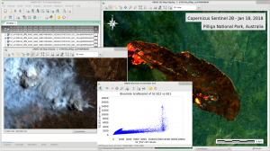
GRASS GIS 7.4.0: Wildfire in Australia, seen by Sentinel-2B

What’s new in a nutshell

After a bit more than one year of development the new update release GRASS GIS 7.4.0 is available. It provides more than 480 stability fixes and improvements compared to the previous stable version 7.2. An overview of the new features in the 7.4 release series is available at New Features in GRASS GIS 7.4.

Efforts have concentrated on making the user experience even better, providing many small, but useful additional functionalities to modules and further improving the graphical user interface. Users can now directly download pre-packaged demo data locations in the GUI startup window. Several modules were migrated from addons to the core GRASS GIS package and the suite of tools for ortho-rectification was re-implemented in the new GRASS 7 GUI style. In order to support the treatment of massive datasets, new compression algorithms were introduced and NULL (no-data) raster files are now also compressed by default. For a detailed overview, see the list of new features. As a stable release series, 7.4.x enjoys long-term support.

Binaries/Installer download:

Source code download:

More details:

See also our detailed announcement:

About GRASS GIS

The Geographic Resources Analysis Support System (https://grass.osgeo.org/), commonly referred to as GRASS GIS, is an Open Source Geographic Information System providing powerful raster, vector and geospatial processing capabilities in a single integrated software suite. GRASS GIS includes tools for spatial modeling, visualization of raster and vector data, management and analysis of geospatial data, and the processing of satellite and aerial imagery. It also provides the capability to produce sophisticated presentation graphics and hardcopy maps. GRASS GIS has been translated into about twenty languages and supports a huge array of data formats. It can be used either as a stand-alone application or as backend for other software packages such as QGIS and R geostatistics. It is distributed freely under the terms of the GNU General Public License (GPL). GRASS GIS is a founding member of the Open Source Geospatial Foundation (OSGeo).

The GRASS Development Team, Feb 2018

GRASS GIS 7.2.2 in action

What’s new in a nutshell

After three months of development the new update release GRASS GIS 7.2.2 is available. It provides more than 120 stability fixes and manual improvements compared to release version 7.2.1. An overview of new features in the 7.2 release series is available at New Features in GRASS GIS 7.2.

About GRASS GIS 7: Its graphical user interface supports the user to make complex GIS operations as simple as possible. The updated Python interface to the C library permits users to create new GRASS GIS-Python modules in a simple way while yet obtaining powerful and fast modules. Furthermore, the libraries were again significantly improved for speed and efficiency, along with support for huge files. A lot of effort has been invested to standardize parameter and flag names. Finally, GRASS GIS 7 comes with a series of new modules to analyse raster and vector data, along with a full temporal framework. For a detailed overview, see the list of new features. As a stable release series, 7.2.x enjoys long-term support.

Binaries/Installer download:

Source code download:

More details:

See also our detailed announcement:

First time users may explore the first steps tutorial after installation.

About GRASS GIS

The Geographic Resources Analysis Support System (https://grass.osgeo.org/), commonly referred to as GRASS GIS, is an Open Source Geographic Information System providing powerful raster, vector and geospatial processing capabilities in a single integrated software suite. GRASS GIS includes tools for spatial modeling, visualization of raster and vector data, management and analysis of geospatial data, and the processing of satellite and aerial imagery. It also provides the capability to produce sophisticated presentation graphics and hardcopy maps. GRASS GIS has been translated into about twenty languages and supports a huge array of data formats. It can be used either as a stand-alone application or as backend for other software packages such as QGIS and R geostatistics. It is distributed freely under the terms of the GNU General Public License (GPL). GRASS GIS is a founding member of the Open Source Geospatial Foundation (OSGeo).

The GRASS Development Team, Sep 2017

We are pleased to announce the update release GRASS GIS 7.2.1

GRASS GIS 7.2.1 in actionWhat’s new in a nutshell

After four months of development the new update release GRASS GIS 7.2.1 is available. It provides more than 150 stability fixes and manual improvements compared to the first stable release version 7.2.0. An overview of new features in this release series is available at New Features in GRASS GIS 7.2.

About GRASS GIS 7: Its graphical user interface supports the user to make complex GIS operations as simple as possible. The updated Python interface to the C library permits users to create new GRASS GIS-Python modules in a simple way while yet obtaining powerful and fast modules. Furthermore, the libraries were again significantly improved for speed and efficiency, along with support for huge files. A lot of effort has been invested to standardize parameter and flag names. Finally, GRASS GIS 7 comes with a series of new modules to analyse raster and vector data, along with a full temporal framework. For a detailed overview, see the list of new features. As a stable release series, 7.2.x enjoys long-term support.

Binaries/Installer download:

Source code download:

More details:

See also our detailed announcement:

https://trac.osgeo.org/grass/wiki/Grass7/NewFeatures72 (overview of new 7.2 stable release series)

https://grass.osgeo.org/grass72/manuals/addons/ (list of available addons)

First time users may explore the first steps tutorial after installation.

About GRASS GIS

The Geographic Resources Analysis Support System (https://grass.osgeo.org/), commonly referred to as GRASS GIS, is an Open Source Geographic Information System providing powerful raster, vector and geospatial processing capabilities in a single integrated software suite. GRASS GIS includes tools for spatial modeling, visualization of raster and vector data, management and analysis of geospatial data, and the processing of satellite and aerial imagery. It also provides the capability to produce sophisticated presentation graphics and hardcopy maps. GRASS GIS has been translated into about twenty languages and supports a huge array of data formats. It can be used either as a stand-alone application or as backend for other software packages such as QGIS and R geostatistics. It is distributed freely under the terms of the GNU General Public License (GPL). GRASS GIS is a founding member of the Open Source Geospatial Foundation (OSGeo).

The GRASS Development Team, May 2017

We are pleased to announce the stable release of GRASS GIS 7.2.0

What’s new in a nutshell

After almost two years of development the new stable major release GRASS GIS 7.2.0 is available. It provides more than 1950 stability fixes and manual improvements compared to the former stable release version 7.0.5. The new version includes a series of new modules to analyse raster and vector data along with new temporal algebra functionality.More than 50 new addons are also available. A summary of the new features is available at New Features in GRASS GIS 7.2.

About GRASS GIS 7: Its graphical user interface supports the user to make complex GIS operations as simple as possible. The updated Python interface to the C library permits users to create new GRASS GIS-Python modules in a simple way while yet obtaining powerful and fast modules. Furthermore, the libraries were again significantly improved for speed and efficiency, along with support for huge files. A lot of effort has been invested to standardize parameter and flag names. Finally, GRASS GIS 7 comes with a series of new modules to analyse raster and vector data, along with a full temporal framework. For a detailed overview, see the list of new features. As a stable release series, 7.2.x enjoys long-term support.

Binaries/Installer download:

Source code download:

More details:

See also our detailed announcement:

First time users may explore the first steps tutorial after installation.

About GRASS GIS

The Geographic Resources Analysis Support System (https://grass.osgeo.org/), commonly referred to as GRASS GIS, is an Open Source Geographic Information System providing powerful raster, vector and geospatial processing capabilities in a single integrated software suite. GRASS GIS includes tools for spatial modeling, visualization of raster and vector data, management and analysis of geospatial data, and the processing of satellite and aerial imagery. It also provides the capability to produce sophisticated presentation graphics and hardcopy maps. GRASS GIS has been translated into about twenty languages and supports a huge array of data formats. It can be used either as a stand-alone application or as backend for other software packages such as QGIS and R geostatistics. It is distributed freely under the terms of the GNU General Public License (GPL). GRASS GIS is a founding member of the Open Source Geospatial Foundation (OSGeo).

The GRASS Development Team, December 2016

We are pleased to announce the first release candidate of GRASS GIS 7.2.0

What’s new in a nutshell

This is the first release candidate of the upcoming major release GRASS GIS 7.2.0.

The new GRASS GIS 7.2.0RC1 release provides more than 1900 stability fixes and manual improvements compared to the stable releases 7.0.x.

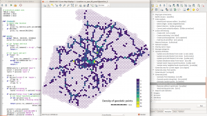
hexagons_python_editorAbout GRASS GIS 7: Its graphical user interface supports the user to make complex GIS operations as simple as possible. The updated Python interface to the C library permits users to create new GRASS GIS-Python modules in a simple way while yet obtaining powerful and fast modules. Furthermore, the libraries were significantly improved for speed and efficiency, along with support for huge files. A lot of effort has been invested to standardize parameter and flag names. Finally, GRASS GIS 7 comes with a series of new modules to analyse raster and vector data, along with a full temporal framework. For a detailed overview, see the list of new features. As a stable release series, 7.2.x enjoys long-term support.

Binaries/Installer download:

Source code download:

More details:

See also our detailed announcement:

https://trac.osgeo.org/grass/wiki/Grass7/NewFeatures (overview of new 7 stable release series)

First time users may explore the first steps tutorial after installation.

About GRASS GIS

The Geographic Resources Analysis Support System (https://grass.osgeo.org/), commonly referred to as GRASS GIS, is an Open Source Geographic Information System providing powerful raster, vector and geospatial processing capabilities in a single integrated software suite. GRASS GIS includes tools for spatial modeling, visualization of raster and vector data, management and analysis of geospatial data, and the processing of satellite and aerial imagery. It also provides the capability to produce sophisticated presentation graphics and hardcopy maps. GRASS GIS has been translated into about twenty languages and supports a huge array of data formats. It can be used either as a stand-alone application or as backend for other software packages such as QGIS and R geostatistics. It is distributed freely under the terms of the GNU General Public License (GPL). GRASS GIS is a founding member of the Open Source Geospatial Foundation (OSGeo).

The GRASS Development Team, October 2016

The new GRASS GIS Project Steering Committee (PSC) is composed of the following nine members (ranking, name, votes):

1 Markus Neteler 62
2 Helena Mitasova 53
3 Martin Landa 52
4 Anna Petrasova 45
5 Moritz Lennert 41
6 Margherita Di Leo 39
7 Michael Barton 35
8 Peter Löwe 33
9 Vaclav Petras 31

More details in earlier announcement sent to the “grass-psc” mailing list:
https://lists.osgeo.org/pipermail/grass-psc/2016-August/001571.html.

For completeness, all relevant candidacy communications, as well as details about the voting process, are published at
https://trac.osgeo.org/grass/wiki/PSC/Election2016

Cited from the original announcement email:
https://lists.osgeo.org/pipermail/grass-announce/2016-September/000119.html

Towards the new stable release series

As of 24 May 2016, a new stable release branch was created for the upcoming GRASS GIS 7.2 release. This new branch includes all the many improvements which have been implemented in the former development version 7.1.svn.

What is a branch? In simple words, it is a kind of directory in the software development server (SVN in our case) in which no more development but only bugfixing happens. From a release branch, new stable releases are created and published.

The actual branches in the GRASS GIS project are:

  • very old stable: releasebranch_6_4 (used for bugfixing and to publish stable GRASS GIS 6.4.x releases) – very low release frequency (started in revision r34936)
  • old stable releasebranch_7_0 (used for bugfixing and to publish stable GRASS GIS 7.0.x releases) – perhaps one last release upcoming (branch started in revision r59487 but development already started in Apr 2008 in r31142)
  • new stable releasebranch_7_2 (used for bugfixing and to publish stable GRASS GIS 7.2.x releases) – upcoming series of stable releases (branch started in revision r68500)
  • trunk (used for development, with pseudo-name 7.3.svn) – under heavy development

Note to SVN users

The trunk branch with pseudo-name 7.1.svn has become 7.3.svn due to the creation of the new 7.2.svn release branch. You can simply continue to update from SVN, the version will be automatically updated.

If you used to work with the 7.0.svn release branch, consider to download the new 7.2.svn release branch, either from the weekly source code snapshot (here) or from the SVN server directly (here).

About GRASS GIS

The Geographic Resources Analysis Support System (https://grass.osgeo.org/), commonly referred to as GRASS GIS, is an Open Source Geographic Information System providing powerful raster, vector and geospatial processing capabilities in a single integrated software suite. GRASS GIS includes tools for spatial modeling, visualization of raster and vector data, management and analysis of geospatial data, and the processing of satellite and aerial imagery. It also provides the capability to produce sophisticated presentation graphics and hardcopy maps. GRASS GIS has been translated into about twenty languages and supports a huge array of data formats. It can be used either as a stand-alone application or as backend for other software packages such as QGIS and R geostatistics. It is distributed freely under the terms of the GNU General Public License (GPL). GRASS GIS is a founding member of the Open Source Geospatial Foundation (OSGeo).

The GRASS Development Team, May 2016

Press release

From March 2016 onwards, Dr. Markus Neteler, a prominent head of the Open Source GIS scene, will join the management board of mundialis GmbH & Co. KG in Bonn, Germany. Founded in 2015, mundialis combines remote sensing and satellite data analysis in the field of Big Data with Open Source WebGIS solutions.

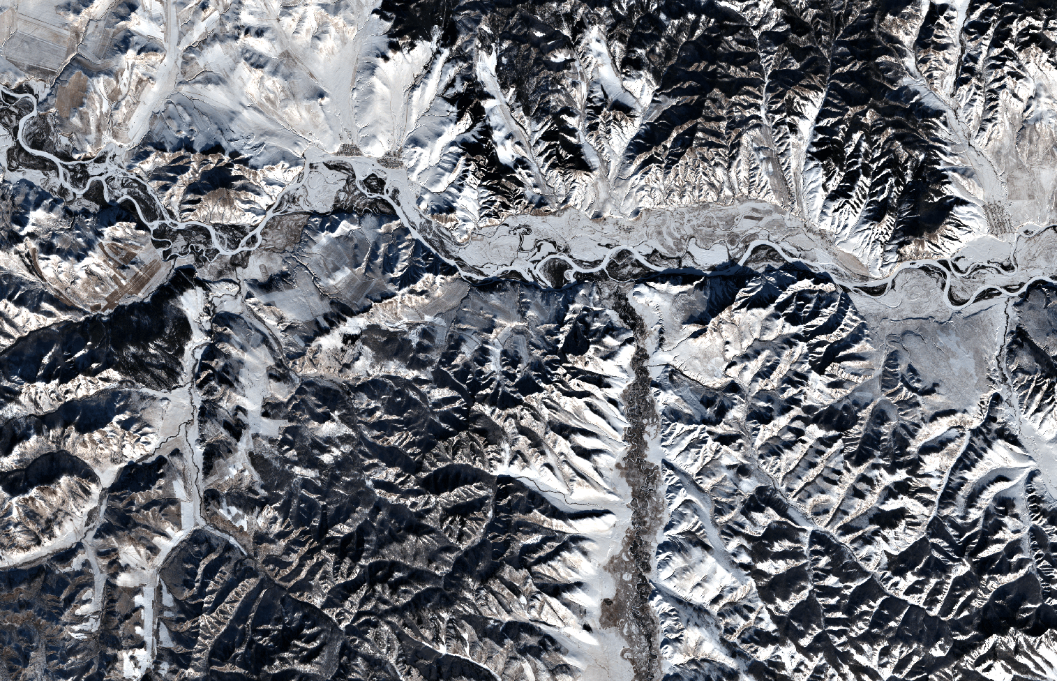
Since 2008, Dr. Neteler was the head of the GIS and remote sensing unit at the Edmund Mach Foundation in Trento (Italy) and worked in this capacity on numerous projects related to biodiversity, environmental and agricultural research. He is also a founding member of the Open Source Geospatial Foundation (OSGeo), a nonprofit organization with headquarters in Delaware (USA), that promotes the development and use of free and open source geographic information systems (GIS). Since 1998 he coordinated the development of the well known GRASS GIS software project, a powerful Open Source GIS that supports processing of time series of several thousand raster, 3D raster or vector maps in a short time. Mongolia as seen by Sentinel-2A

Markus will keep his role as “Mr. GRASS” at mundialis, especially because the company also sees itself as a research and development enterprise that puts its focus on the open source interfaces between geoinformation and remote sensing. Although a new company, mundialis offers more than 50 years of experience in GIS, due to the background of its management. Besides Neteler, there are Till Adams and Hinrich Paulsen, both at the same time the founders and CEOs of terrestris in Bonn, a company that develops Open Source GIS solutions since 2002. These many years of experience in the construction of WebGIS and Geoportal architectures using free software as well as in the application of common OGC standards – are now combined with mundialis’ expertise in the processing of big data with spatial reference and remote sensing data.

Contact: https://www.mundialis.de/

What’s new in a nutshell

The new GRASS GIS 7.0.2 release provides 190 stability fixes and manual improvements.

About GRASS GIS 7: Its graphical user interface supports the user to make complex GIS operations as simple as possible. The updated Python interface to the C library permits users to create new GRASS GIS-Python modules in a simple way while yet obtaining powerful and fast modules. Furthermore, the libraries were significantly improved for speed and efficiency, along with support for huge files. A lot of effort has been invested to standardize parameter and flag names. Finally, GRASS GIS 7 comes with a series of new modules to analyse raster and vector data, along with a full temporal framework. For a detailed overview, see the list of new features. As a stable release series, 7.0.x enjoys long-term support.

Source code download:

Binaries download:

More details:

See also our detailed announcement:

  https://trac.osgeo.org/grass/wiki/Grass7/NewFeatures (overview of new 7.0 stable release series)First time users may explore the first steps tutorial after installation.

About GRASS GIS

The Geographic Resources Analysis Support System (https://grass.osgeo.org/), commonly referred to as GRASS GIS, is an Open Source Geographic Information System providing powerful raster, vector and geospatial processing capabilities in a single integrated software suite. GRASS GIS includes tools for spatial modeling, visualization of raster and vector data, management and analysis of geospatial data, and the processing of satellite and aerial imagery. It also provides the capability to produce sophisticated presentation graphics and hardcopy maps. GRASS GIS has been translated into about twenty languages and supports a huge array of data formats. It can be used either as a stand-alone application or as backend for other software packages such as QGIS and R geostatistics. It is distributed freely under the terms of the GNU General Public License (GPL). GRASS GIS is a founding member of the Open Source Geospatial Foundation (OSGeo).

The GRASS Development Team, November 2015

What’s new in a nutshellgrass7_logo_500px

This release addresses some minor issues found in the first GRASS GIS 7.0.0 release published earlier this year. The new release provides a series of stability fixes in the core system and the graphical user interface, PyGRASS improvements, some manual enhancements, and a few language translations.

This release is the 32nd birthday release of GRASS GIS.

New in GRASS GIS 7: Its new graphical user interface supports the user in making complex GIS operations as simple as possible. A new Python interface to the C library permits users to create new GRASS GIS-Python modules in a simple way while yet obtaining powerful and fast modules. Furthermore, the libraries were significantly improved for speed and efficiency, along with support for huge files. A lot of effort has been invested to standardize parameter and flag names. Finally, GRASS GIS 7 comes with a series of new modules to analyse raster and vector data, along with a full temporal framework. For a detailed overview, see the list of new features. As a stable release 7.0 enjoys long-term support.

Source code download:

Binaries download:

More details:

See also our detailed announcement:

  https://trac.osgeo.org/grass/wiki/Grass7/NewFeatures (overview of new stable release series)First time users may explore the first steps tutorial after installation.

About GRASS GIS

The Geographic Resources Analysis Support System (https://grass.osgeo.org/), commonly referred to as GRASS GIS, is an Open Source Geographic Information System providing powerful raster, vector and geospatial processing capabilities in a single integrated software suite. GRASS GIS includes tools for spatial modeling, visualization of raster and vector data, management and analysis of geospatial data, and the processing of satellite and aerial imagery. It also provides the capability to produce sophisticated presentation graphics and hardcopy maps. GRASS GIS has been translated into about twenty languages and supports a huge array of data formats. It can be used either as a stand-alone application or as backend for other software packages such as QGIS and R geostatistics. It is distributed freely under the terms of the GNU General Public License (GPL). GRASS GIS is a founding member of the Open Source Geospatial Foundation (OSGeo).

The GRASS Development Team, July 2015